ZCZC MIATWOAT ALL
TTAA00 KNHC DDHHMM
Tropical Weather Outlook
NWS National Hurricane Center Miami FL
800 AM EDT Wed Aug 9 2017
For the North Atlantic...Caribbean Sea and the Gulf of Mexico:
The National Hurricane Center is issuing advisories on Tropical
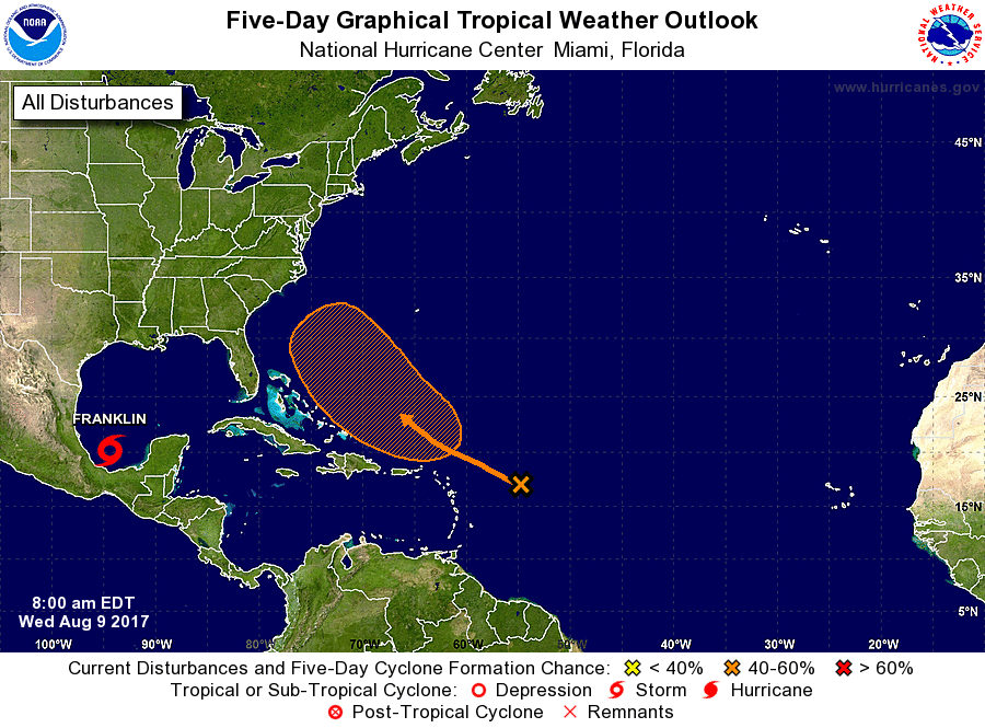
Storm Franklin, located over the Bay of Campeche.
1. Shower activity has increased a little this morning in association
with a trough of low pressure located about 400 miles east of the
Leeward Islands. Significant development of this system is not
expected during the next couple of days due to unfavorable
environmental conditions. However, conditions are forecast to
become somewhat conducive for development of this system late this
week and this weekend while it moves west-northwestward
to northwestward over the western Atlantic.
* Formation chance through 48 hours...low...near 0 percent.
* Formation chance through 5 days...medium...40 percent.
Forecaster Cangialosi