ZCZC MIATWOAT ALL
TTAA00 KNHC DDHHMM
Tropical Weather Outlook
NWS National Hurricane Center Miami FL
800 AM EDT Wed Aug 2 2017
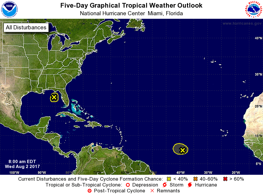
For the North Atlantic...Caribbean Sea and the Gulf of Mexico:
1. Shower activity has decreased in association with a broad trough
of low pressure that extends from the central Gulf of Mexico
northeastward into Apalachee Bay. Development of this system is not
expected due to strong upper-level winds and proximity to dry air.
The trough is forecast to move slowly northward or northeastward
and weaken over the southeastern United States through Friday.
* Formation chance through 48 hours...low...near 0 percent.
* Formation chance through 5 days...low...near 0 percent.
2. A tropical wave is producing a small area of disorganized shower
activity several hundred miles southwest of the Cabo Verde Islands.
Environmental conditions are expected to become unfavorable for
development while this system moves westward at 10 to 15 mph during
the next several days.
* Formation chance through 48 hours...low...near 0 percent.
* Formation chance through 5 days...low...near 0 percent.
Forecaster Stewart