ZCZC MIATWOAT ALL
TTAA00 KNHC DDHHMM
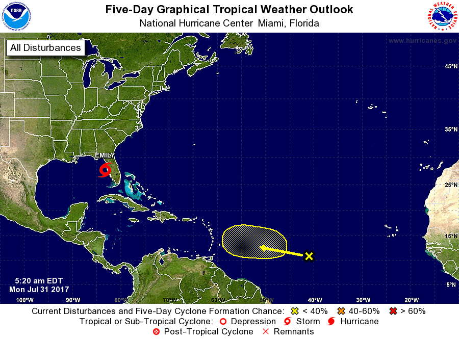
Special Tropical Weather Outlook
NWS National Hurricane Center Miami FL
520 AM EDT Mon Jul 31 2017
For the North Atlantic...Caribbean Sea and the Gulf of Mexico:
Special tropical weather outlook issued to update the discussion of
the low pressure area over the eastern Gulf of Mexico.
1. Updated: Radar data indicate that showers and thunderstorms
associated with the small area of low pressure located about 75
miles west of Tampa, Florida, have continued to become better
organized, and a tropical depression has formed. Advisories will be
initiated on this system as Tropical Depression Six within the next
hour.
* Formation chance through 48 hours...high...near 100 percent.
* Formation chance through 5 days...high...near 100 percent.
2. Shower activity associated with a tropical wave located about
midway between west Africa and the Lesser Antilles remains limited.
Any development of this system is expected to be slow to occur
over the next several days while the system moves westward to
west-northwestward at 10 to 15 mph.
* Formation chance through 48 hours...low...near 0 percent.
* Formation chance through 5 days...low...10 percent.
Forecaster Brown/Brennan