ZCZC MIATWOAT ALL
TTAA00 KNHC DDHHMM
Tropical Weather Outlook
NWS National Hurricane Center Miami FL
200 AM EDT Tue Jul 18 2017
For the North Atlantic...Caribbean Sea and the Gulf of Mexico:
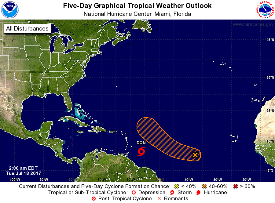
The National Hurricane Center is issuing advisories on Tropical
Storm Don, located about 300 miles east-southeast of Barbados.
1. A tropical wave, accompanied by a well-defined low pressure system,
is located over the central tropical Atlantic several hundred miles
west-southwest of the Cabo Verde Islands. Some gradual development
of this system is possible through mid-week while it moves toward
the west-northwest or northwest at 10 to 15 mph. After that time,
environmental conditions are forecast to become less conducive for
development.
* Formation chance through 48 hours...low...30 percent.
* Formation chance through 5 days...medium...40 percent.
Public Advisories on Tropical Storm Don are issued under WMO header
WTNT35 KNHC and under AWIPS header MIATCPAT5.
Forecast/Advisories on Tropical Storm Don are issued under WMO
header WTNT25 KNHC and under AWIPS header MIATCMAT5.
Forecaster Stewart