ZCZC MIATWOAT ALL
TTAA00 KNHC DDHHMM
Tropical Weather Outlook
NWS National Hurricane Center Miami FL
800 PM EDT Sun Jul 16 2017
For the North Atlantic...Caribbean Sea and the Gulf of Mexico:
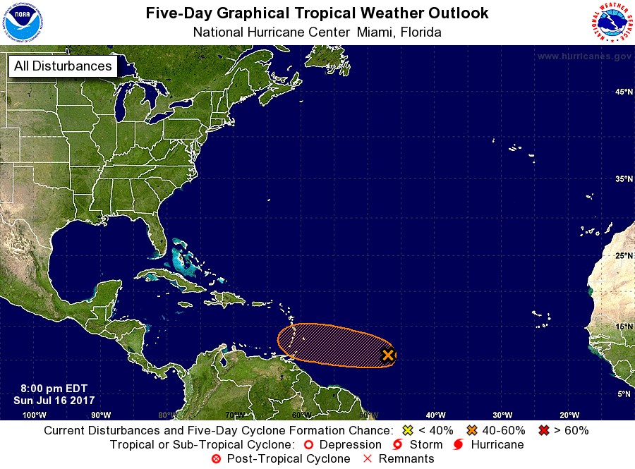
1. A weak area of low pressure located about 900 miles east-southeast
of the Windward Islands continues to produce disorganized showers
and thunderstorms. Environmental conditions are marginally
conducive for some development of this system before it reaches the
Lesser Antilles in two to three days. After that time, less
favorable upper-level winds are expected to hinder additional
development. An Air Force Reserve reconnaissance aircraft is
scheduled to investigate the disturbance Monday afternoon, if
necessary.
* Formation chance through 48 hours...low...30 percent.
* Formation chance through 5 days...medium...40 percent.
Forecaster Pasch