ZCZC MIATWOAT ALL
TTAA00 KNHC DDHHMM
Tropical Weather Outlook
NWS National Hurricane Center Miami FL
800 PM EDT Thu Jun 15 2017
For the North Atlantic...Caribbean Sea and the Gulf of Mexico:
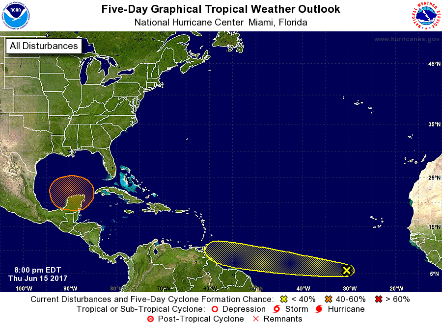
1. A tropical wave located several hundred miles south-southwest of
the Cabo Verde Islands is producing disorganized showers and
thunderstorms. Development, if any, of this system should be slow
to occur during the next few days while the wave moves westward near
20 mph over the tropical Atlantic.
* Formation chance through 48 hours...low...10 percent.
* Formation chance through 5 days...low...20 percent.
2. A broad area of low pressure is expected to form over the
northwestern Caribbean Sea and the Yucatan peninsula this
weekend. Conditions appear to be favorable for gradual development
of this system while it moves slowly northwestward toward the
southern Gulf of Mexico early next week.
* Formation chance through 48 hours...low...near 0 percent.
* Formation chance through 5 days...medium...50 percent.
Forecaster Avila