ZCZC MIATWOAT ALL
TTAA00 KNHC DDHHMM
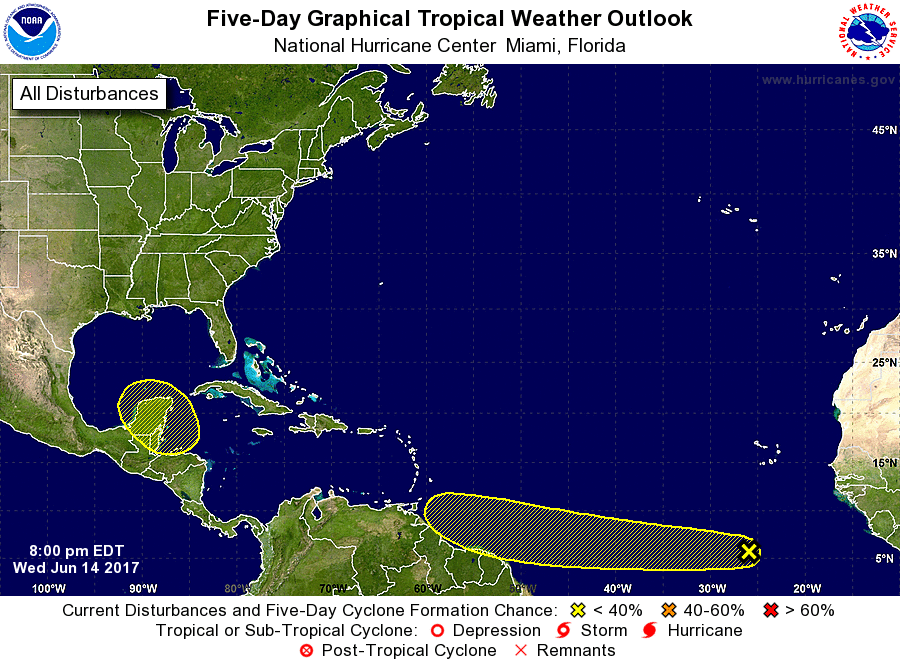
Tropical Weather Outlook
NWS National Hurricane Center Miami FL
800 PM EDT Wed Jun 14 2017
For the North Atlantic...Caribbean Sea and the Gulf of Mexico:
1. An area of disturbed weather associated with a tropical wave is
located well south of the Cabo Verde Islands. Some slight
development of this system is possible during the next few days
while the wave moves westward near 20 mph over the tropical
Atlantic.
* Formation chance through 48 hours...low...10 percent.
* Formation chance through 5 days...low...20 percent.
2. A complex area of low pressure is expected to form over the
northwestern Caribbean Sea and the adjacent Yucatan peninsula by the
weekend. Conditions appear to be favorable for some gradual
development of this system while it moves slowly northwestward
toward the southern Gulf of Mexico by early next week.
* Formation chance through 48 hours...low...near 0 percent.
* Formation chance through 5 days...low...30 percent.
Forecaster Avila