ZCZC MIATWOAT ALL
TTAA00 KNHC DDHHMM
Tropical Weather Outlook
NWS National Hurricane Center Miami FL
200 AM EDT Wed Jun 14 2017
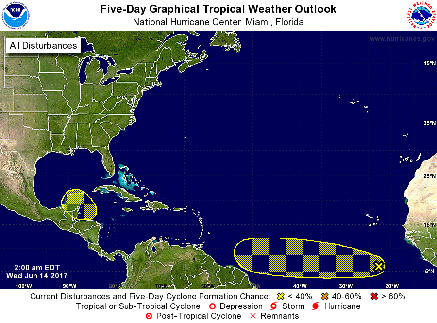
For the North Atlantic...Caribbean Sea and the Gulf of Mexico:
1. A strong tropical wave over the far eastern Atlantic Ocean is
producing a large area of showers and thunderstorms well south of
the Cabo Verde Islands. Development, if any, of this system is
expected to be slow to occur over the next several days while the
wave moves westward at 15 to 20 mph over the low-latitude tropical
Atlantic.
* Formation chance through 48 hours...low...10 percent.
* Formation chance through 5 days...low...20 percent.
2. A broad area of low pressure is expected to form over the
northwestern Caribbean Sea and adjacent land areas by the weekend.
Some gradual development of this system is possible thereafter while
it moves slowly northwestward toward the southwestern Gulf of
Mexico.
* Formation chance through 48 hours...low...near 0 percent.
* Formation chance through 5 days...low...20 percent.
Forecaster Blake