ZCZC MIATWOAT ALL
TTAA00 KNHC DDHHMM
Special Tropical Weather Outlook
NWS National Hurricane Center Miami FL
130 AM EDT Wed Apr 19 2017
For the North Atlantic...Caribbean Sea and the Gulf of Mexico:
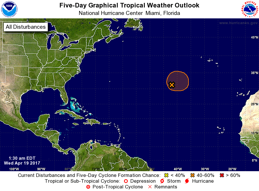
1. A non-tropical low pressure system is located over the central
Atlantic more than 700 miles southwest of the Azores. Showers and
thunderstorms have become a little better organized since yesterday,
and winds to near gale force have developed northeast through
southeast of the well-defined center. This system still has the
opportunity to become a subtropical cyclone during the next day or
so before it becomes absorbed by a larger extratropical cyclone on
Thursday. The next Special Tropical Weather Outlook will be issued
by 2 PM EDT this afternoon. For additional information on this
system, please see High Seas Forecasts issued by the National
Weather Service.
* Formation chance through 48 hours...medium...50 percent
* Formation chance through 5 days...medium...50 percent
High Seas Forecasts issued by the National Weather Service can be
found under AWIPS header NFDHSFAT1, WMO header FZNT01 KWBC, and on
the Web at http://www.opc.ncep.noaa.gov/shtml/NFDHSFAT1.shtml.
Forecaster Stewart