ZCZC MIATWOAT ALL
TTAA00 KNHC DDHHMM
Special Tropical Weather Outlook
NWS National Hurricane Center Miami FL
130 PM EDT Tue Apr 18 2017
For the North Atlantic...Caribbean Sea and the Gulf of Mexico:
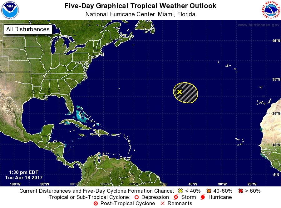
1. A non-tropical low pressure system is located over the central
Atlantic about midway between Bermuda and the Azores Islands. This
low is producing disorganized cloudiness and showers, and an area of
gusty winds to the west of the center. This system has the
opportunity to become a subtropical cyclone over the next 24 hours
before it becomes absorbed by a larger extratropical cyclone. The
next Special Tropical Weather Outlook will be issued by 2 PM EDT
Wednesday. For additional information on this system, please
see High Seas Forecasts issued by the National Weather Service.
* Formation chance through 48 hours...low...30 percent
* Formation chance through 5 days...low...30 percent
High Seas Forecasts issued by the National Weather Service can be
found under AWIPS header NFDHSFAT1, WMO header FZNT01 KWBC, and on
the Web at http://www.opc.ncep.noaa.gov/shtml/NFDHSFAT1.shtml.
Forecaster Avila