ZCZC MIATWOAT ALL
TTAA00 KNHC DDHHMM
TROPICAL WEATHER OUTLOOK
NWS NATIONAL HURRICANE CENTER MIAMI FL
100 AM EST MON NOV 21 2016
For the North Atlantic...Caribbean Sea and the Gulf of Mexico:
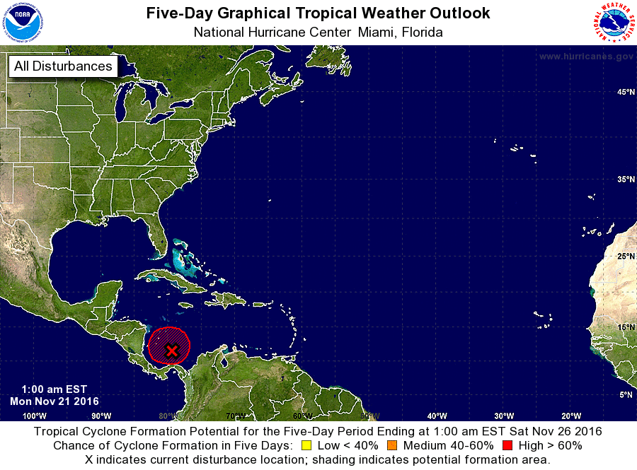
1. Thunderstorm activity associated with a small but well-defined low
pressure system located over the extreme southwestern Caribbean Sea
has continued to increase and become better organized over the past
several hours, and a tropical depression or a tropical storm appears
to be forming. If this development trend continues, then advisories
will likely be issued on this disturbance later this morning. For
additional information on this system, see High Seas Forecasts
issued by the National Weather Service.
* Formation chance through 48 hours...high...90 percent
* Formation chance through 5 days...high...90 percent
High Seas Forecasts issued by the National Weather Service can be
found under AWIPS header NFDHSFAT1, WMO header FZNT01 KWBC, and
at http://www.opc.ncep.noaa.gov/shtml/NFDHSFAT1.shtml.
Forecaster Stewart