ZCZC MIATWOAT ALL
TTAA00 KNHC DDHHMM
TROPICAL WEATHER OUTLOOK
NWS NATIONAL HURRICANE CENTER MIAMI FL
800 AM EDT WED NOV 2 2016
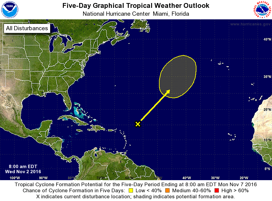
For the North Atlantic...Caribbean Sea and the Gulf of Mexico:
1. A broad non-tropical area of low pressure located a few hundred
miles east-northeast of the northern Lesser Antilles is producing
widespread cloudiness and showers. Although this system is
expected to strengthen into a non-tropical gale over the
central Atlantic within the next day or so, it could acquire some
subtropical characteristics late this week or this weekend
while it moves northward or north-northeastward over the
north-central Atlantic. Additional information on this system
can be found in High Seas Forecasts issued by the National Weather
Service.
* Formation chance through 48 hours...low...near 0 percent
* Formation chance through 5 days...low...20 percent
High Seas Forecasts issued by the National Weather Service
can be found under AWIPS header NFDHSFAT1, WMO header FZNT01 KWBC,
and available on the Web at
http://www.opc.ncep.noaa.gov/shtml/NFDHSFAT1.shtml.
Forecaster Brown