ZCZC MIATWOAT ALL
TTAA00 KNHC DDHHMM
TROPICAL WEATHER OUTLOOK
NWS NATIONAL HURRICANE CENTER MIAMI FL
200 PM EDT THU OCT 20 2016
For the North Atlantic...Caribbean Sea and the Gulf of Mexico:
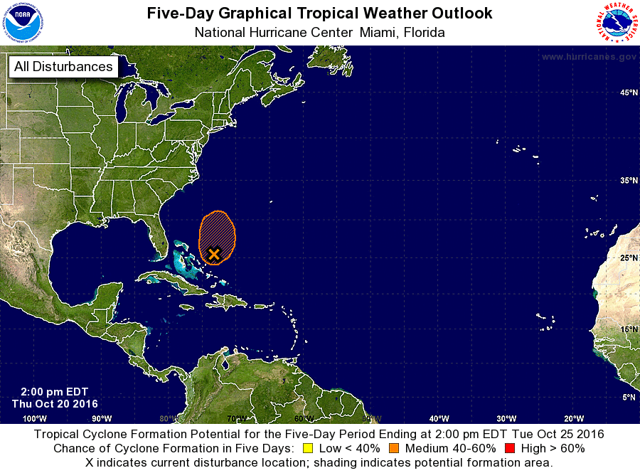
1. A broad area of low pressure located a couple of hundred miles
northeast of the Central Bahamas is moving slowly and erratically,
but is expected to begin moving northward by tonight. Although
visible satellite imagery and surface observations suggest that the
low-level circulation has become a little better defined since
yesterday, preliminary reports from a NOAA reconnaissance aircraft
indicate that the system does not have a well-defined center. In
addition, the associated shower and thunderstorm activity is limited
and not well organized. This system could still become a
subtropical or tropical cyclone before it merges with a cold front
over the western Atlantic, well offshore of the United States east
coast Friday night. Regardless of development, locally heavy
rainfall along with life-threatening flash floods and mud slides are
likely over portions of Hispaniola for the next day or so.
* Formation chance through 48 hours...medium...50 percent
* Formation chance through 5 days...medium...50 percent
Forecaster Pasch