ZCZC MIATWOAT ALL
TTAA00 KNHC DDHHMM
TROPICAL WEATHER OUTLOOK
NWS NATIONAL HURRICANE CENTER MIAMI FL
200 PM EDT WED OCT 19 2016
For the North Atlantic...Caribbean Sea and the Gulf of Mexico:
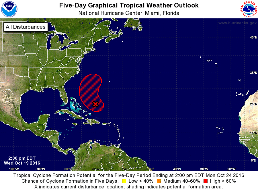
1. A broad, non-tropical low pressure system is located about 250 miles
northeast of the Turks and Caicos Islands. Although shower and
thunderstorm activity has decreased and become less organized since
yesterday, environmental conditions are forecast to become a little
more conducive for the low to acquire some tropical characteristics,
and a subtropical or tropical cyclone is likely to form within the
next couple of days. The low is forecast to move northwestward
tonight and Thursday, then turn north-northeastward on Friday, and
merge with a cold front over the western Atlantic by the weekend. A
NOAA reconnaissance aircraft is scheduled to investigate this system
Thursday afternoon, if necessary. Regardless of development, locally
heavy rainfall is possible over Hispaniola, Puerto Rico, and
portions of the northern Leeward Islands through tonight.
* Formation chance through 48 hours...medium...60 percent
* Formation chance through 5 days...high...80 percent
Forecaster Stewart