ZCZC MIATWOAT ALL
TTAA00 KNHC DDHHMM
TROPICAL WEATHER OUTLOOK
NWS NATIONAL HURRICANE CENTER MIAMI FL
200 PM EDT TUE OCT 18 2016
For the North Atlantic...Caribbean Sea and the Gulf of Mexico:
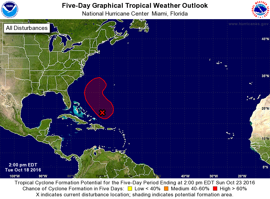
1. Shower and thunderstorm activity has increased and become a little
better organized since yesterday in association with a well-defined,
non-tropical low pressure system located a couple of hundred miles
northeast of the Turks and Caicos. The low is expected to acquire
some tropical characteristics as upper-level winds become more
conducive, and a subtropical or tropical cyclone will likely form
during the next few days. The low is forecast to move northward on
Wednesday and turn northwestward on Thursday, before heading
northeastward out to sea by the end of the week. A NOAA Hurricane
Hunter aircraft is scheduled to investigate this system tomorrow
afternoon, if necessary.
* Formation chance through 48 hours...medium...50 percent
* Formation chance through 5 days...high...80 percent
Forecaster Stewart