ZCZC MIATWOAT ALL
TTAA00 KNHC DDHHMM
TROPICAL WEATHER OUTLOOK
NWS NATIONAL HURRICANE CENTER MIAMI FL
200 AM EDT MON OCT 17 2016
For the North Atlantic...Caribbean Sea and the Gulf of Mexico:
The National Hurricane Center is issuing advisories on Hurricane
Nicole, located several hundred miles southeast of Cape Race,
Newfoundland.
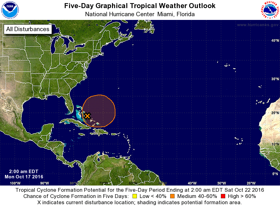
1. A large area of cloudiness and disorganized showers located over
the Bahamas and adjacent western Atlantic waters is associated with
a surface trough that is interacting with an upper-level low.
Upper-level winds are currently unfavorable for significant
development, but they could become more conducive for tropical or
subtropical cyclone formation by Tuesday or Wednesday when the
system begins to drift northward or north-northwestward.
Regardless of development, locally heavy rainfall is possible
over much of the Bahamas during the next couple of days.
* Formation chance through 48 hours...low...20 percent
* Formation chance through 5 days...medium...40 percent
Forecaster Pasch