ZCZC MIATWOAT ALL
TTAA00 KNHC DDHHMM
TROPICAL WEATHER OUTLOOK
NWS NATIONAL HURRICANE CENTER MIAMI FL
800 AM EDT THU OCT 6 2016
For the North Atlantic...Caribbean Sea and the Gulf of Mexico:
The National Hurricane Center is issuing advisories on Hurricane
Matthew, located over the Bahamas, and on Tropical Storm
Nicole, located several hundred miles south of Bermuda.
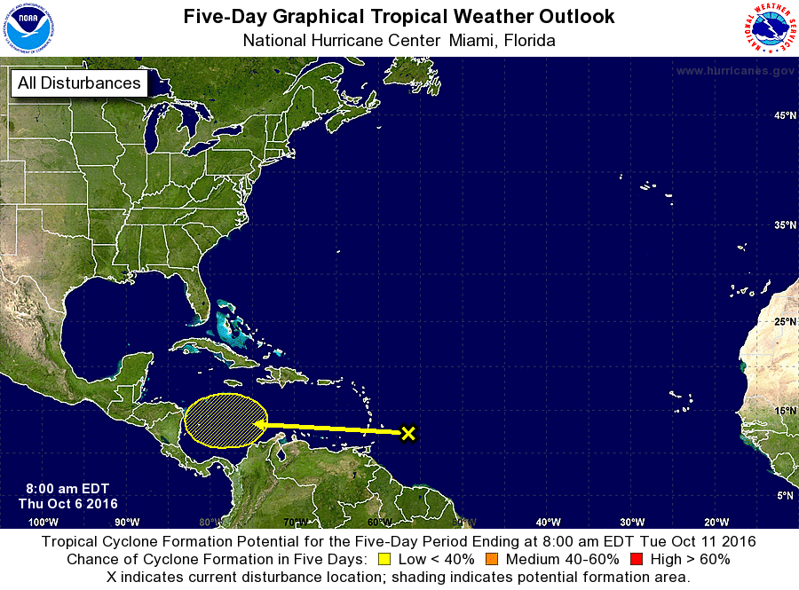
1. A concentrated area of showers and thunderstorms approaching the
Lesser Antilles is associated with a tropical wave. Development,
if any, of this disturbance is expected to be slow to occur while
the wave moves westward through the Caribbean Sea through early
next week. Locally heavy rains and gusty winds are possible in the
Windward and southern Leeward Islands during the next day or two as
the system moves through the area.
* Formation chance through 48 hours...low...near 0 percent
* Formation chance through 5 days...low...10 percent
Forecaster Kimberlain