ZCZC MIATWOAT ALL
TTAA00 KNHC DDHHMM
TROPICAL WEATHER OUTLOOK
NWS NATIONAL HURRICANE CENTER MIAMI FL
800 AM EDT SUN OCT 2 2016
For the North Atlantic...Caribbean Sea and the Gulf of Mexico:
The National Hurricane Center is issuing advisories on Hurricane
Matthew, located over the central Caribbean Sea.
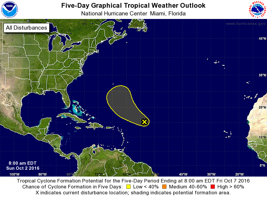
1. A broad low pressure system located about 600 miles east-northeast
of the Leeward Islands continues to produce an area of showers and
thunderstorms. Some development of this system is possible during
the next couple of days before upper-level winds become less
conducive for development. This system is expected to move
west-northwestward or northwestward at 15 mph during the next
several days.
* Formation chance through 48 hours...low...20 percent
* Formation chance through 5 days...low...30 percent
Forecaster Cangialosi