ZCZC MIATWOAT ALL
TTAA00 KNHC DDHHMM
TROPICAL WEATHER OUTLOOK
NWS NATIONAL HURRICANE CENTER MIAMI FL
800 AM EDT SUN SEP 18 2016
For the North Atlantic...Caribbean Sea and the Gulf of Mexico:
The National Hurricane Center is issuing advisories on Tropical
Depression Julia, located a couple of hundred miles southeast of the
coast of South Carolina, and on Tropical Storm Karl, located midway
between the Leeward Islands and Africa.
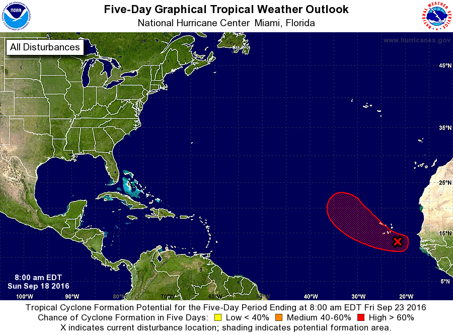
1. An elongated area of low pressure located a couple of hundred miles
east through southeast of the Cabo Verde Islands is producing a
broad area of cloudiness and thunderstorms. Environmental conditions
are expected to be conducive for development, and a tropical
depression is likely to form by mid-week while the low moves
west-northwestward to northwestward across the eastern tropical
Atlantic. Regardless of development, locally heavy rains and gusty
winds are possible in the Cabo Verde Islands during the next couple
of days.
* Formation chance through 48 hours...medium...40 percent
* Formation chance through 5 days...high...70 percent
Forecaster Stewart