ZCZC MIATWOAT ALL
TTAA00 KNHC DDHHMM
TROPICAL WEATHER OUTLOOK
NWS NATIONAL HURRICANE CENTER MIAMI FL
200 AM EDT SAT SEP 17 2016
For the North Atlantic...Caribbean Sea and the Gulf of Mexico:
The National Hurricane Center is issuing advisories on recently
downgraded Tropical Depression Julia, located a couple hundred miles
southeast of the coast of South Carolina, and on Tropical Storm
Karl, located almost a thousand miles west-northwest of the Cabo
Verde Islands.
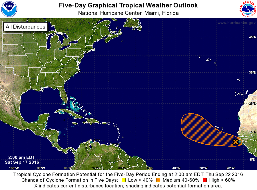
1. A tropical wave located just offshore of the west coast of Africa is
accompanied by disorganized shower and thunderstorm activity.
Environmental conditions appear conducive for gradual development,
and a tropical depression could form by the middle of next week
while this system moves westward to west-northwestward across the
eastern tropical Atlantic. Regardless of tropical cyclone
formation, this system could bring rain and gusty winds to portions
of the Cabo Verde Islands during the next couple of days.
* Formation chance through 48 hours...low...30 percent
* Formation chance through 5 days...medium...60 percent
Forecaster Brennan