ZCZC MIATWOAT ALL
TTAA00 KNHC DDHHMM
TROPICAL WEATHER OUTLOOK
NWS NATIONAL HURRICANE CENTER MIAMI FL
200 PM EDT THU SEP 8 2016
For the North Atlantic...Caribbean Sea and the Gulf of Mexico:
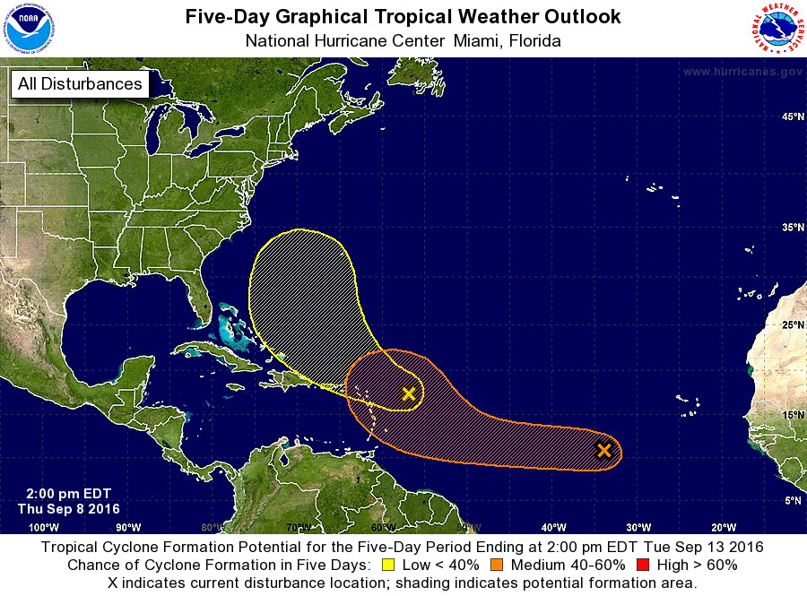
1. A large but disorganized area of disturbed weather located about
600 miles southwest of the Cabo Verde Islands is associated with a
westward-moving tropical wave. Development of this system during
the next couple of days, if any, will likely be very slow. However,
conditions are forecast to become more favorable early next week,
and a tropical depression could form in the open central Atlantic
while the system moves northwestward.
* Formation chance through 48 hours...low...10 percent
* Formation chance through 5 days...medium...60 percent
2. An area of showers and thunderstorms is located about 275 miles east
of the northern Leeward Islands. Pressures remain high in the area,
and there are no signs of a surface circulation. During the next few
days, this system is expected to move toward the west-northwest
where conditions are not favorable for significant development.
* Formation chance through 48 hours...low...10 percent
* Formation chance through 5 days...low...20 percent
Forecaster Avila