ZCZC MIATWOAT ALL
TTAA00 KNHC DDHHMM
TROPICAL WEATHER OUTLOOK
NWS NATIONAL HURRICANE CENTER MIAMI FL
200 AM EDT FRI SEP 2 2016
For the North Atlantic...Caribbean Sea and the Gulf of Mexico:
The National Hurricane Center is issuing advisories on Hurricane
Gaston, located west of the Azores, and on Hurricane Hermine,
located near the coast of the Florida Big Bend.
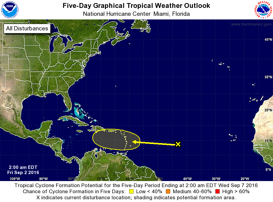
1. A tropical wave over the central tropical Atlantic Ocean located a
little more than 1000 miles east of the Lesser Antilles is
accompanied by a few showers and thunderstorms. Development of this
system, if any, will be slow to occur while it approaches the Lesser
Antilles and continues westward into the eastern Caribbean Sea
early next week.
* Formation chance through 48 hours...low...10 percent
* Formation chance through 5 days...low...20 percent
Forecaster Avila