ZCZC MIATWOAT ALL
TTAA00 KNHC DDHHMM
TROPICAL WEATHER OUTLOOK
NWS NATIONAL HURRICANE CENTER MIAMI FL
800 AM EDT THU SEP 1 2016
For the North Atlantic...Caribbean Sea and the Gulf of Mexico:
The National Hurricane Center is issuing advisories on Hurricane
Gaston, located west of the Azores, and on Tropical Storm
Hermine, located over the central Gulf of Mexico. The National
Hurricane Center has issued the last advisory on former Tropical
Depression Eight, located east of the Mid-Atlantic states.
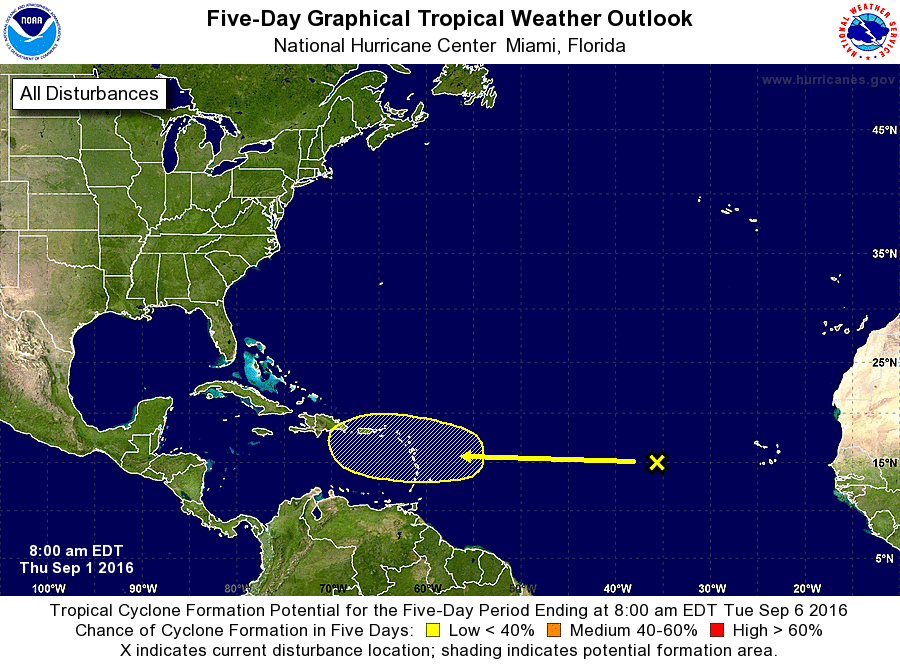
1. A tropical wave over the eastern Atlantic ocean located about 700
miles west of the Cabo Verde Islands continues to produce only
limited shower activity. This wave is expected to be in an
environment of very dry air for the next few days, which should
prevent significant development during that time. Environmental
conditions could become a little more conducive for some development
when the wave is near the Lesser Antilles early next week.
* Formation chance through 48 hours...low...near 0 percent
* Formation chance through 5 days...low...20 percent
Forecaster Blake