ZCZC MIATWOAT ALL
TTAA00 KNHC DDHHMM
TROPICAL WEATHER OUTLOOK
NWS NATIONAL HURRICANE CENTER MIAMI FL
800 AM EDT THU AUG 25 2016
For the North Atlantic...Caribbean Sea and the Gulf of Mexico:
The National Hurricane Center is issuing advisories on recently
upgraded Hurricane Gaston, located about 1200 miles east of the
Leeward Island.
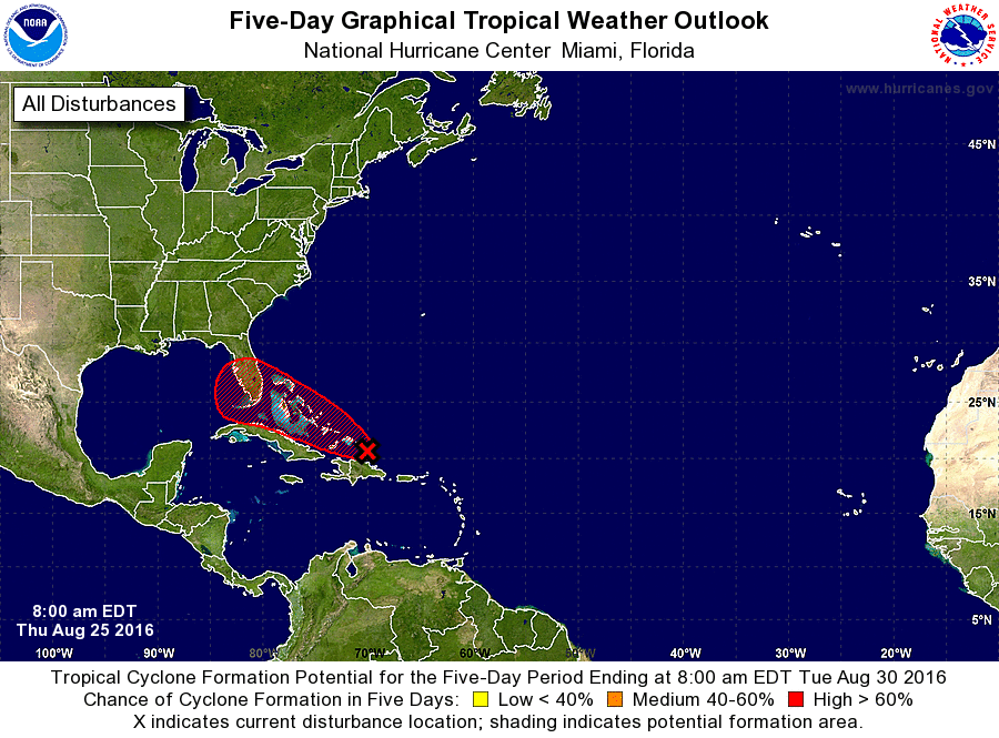
1. An area of low pressure associated with a tropical wave is
centered just southeast of the Turks and Caicos Islands. The wave
is producing gale-force winds over water to the north of
Hispaniola, however, satellite images indicate that the shower and
thunderstorm activity is well removed from the area of lowest
pressure. Surface data also indicate that the low continues to
lack a well-defined center. Although upper-level winds are only
marginally conducive for development during the next day or so,
they are expected to become a little more favorable by the weekend,
and this system could become a tropical depression during the next
couple of days. An Air Force Reserve Hurricane Hunter aircraft is
scheduled to investigate the wave later this morning.
Regardless of development, heavy rains are likely over Puerto Rico
today, and strong winds and heavy rainfall are likely over portions
of Hispaniola, the Turks and Caicos, and the southeastern and
central Bahamas during the next couple of days. These rains could
lead to flash floods and mudslides. Please consult products issued
by your local meteorological offices and High Seas Forecasts from
the National Weather Service for further details.
Interests in the northwestern Bahamas and Florida should monitor the
progress of this disturbance since it is increasing likely that
some impacts, at a minimum heavy rains and gusty winds, will occur
beginning this weekend.
* Formation chance through 48 hours...medium...50 percent
* Formation chance through 5 days...high...80 percent
High Seas Forecasts issued by the National Weather Service can be
found under AWIPS header NFDHSFAT1, WMO header FZNT01 KWBC, and
on the Web at http://www.opc.ncep.noaa.gov/shtml/NFDHSFAT1.shtml.
Forecaster Brown/Brennan