ZCZC MIATWOAT ALL
TTAA00 KNHC DDHHMM
TROPICAL WEATHER OUTLOOK
NWS NATIONAL HURRICANE CENTER MIAMI FL
200 PM EDT WED AUG 24 2016
For the North Atlantic...Caribbean Sea and the Gulf of Mexico:
The National Hurricane Center is issuing advisories on Tropical
Storm Gaston, located about 1000 miles west of the Cabo Verde
Islands.
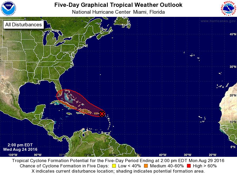
1. A strong tropical wave and associated broad area of low pressure is
moving westward across the northern Leeward Islands and Puerto Rico.
Reports from an Air Force Reconnaissance aircraft and surface
observations indicate that the system still lacks a well-defined
circulation, but it nevertheless is producing tropical-storm-force
winds in squalls over the northernmost Leeward Islands and adjacent
waters. Although upper-level winds are expected to be only
marginally conducive for additional development, this system could
become a tropical storm or tropical depression at any time during
the next couple of days. Environmental conditions could become more
conducive for development by the weekend when the system is near the
central or northwestern Bahamas.
Regardless of development, squalls to tropical storm force can be
expected over portions of the northern Leeward Islands and the
northern U.S. and British Virgin Islands this afternoon. Strong
winds, heavy rains, and possible flash floods and mudslides are
expected to occur over portions of the Leeward Islands, Puerto Rico,
Hispaniola, and the southeastern and central Bahamas during the next
couple of days. Please consult products issued by your local
meteorological offices and High Seas Forecasts from the National
Weather Service for further details.
Interests in the northwestern Bahamas and Florida should monitor the
progress of this disturbance. Because of the large uncertainties
regarding this system's development and future track, it is too
early to speculate on what specific impacts might occur in the
northwestern Bahamas, Florida or beyond.
* Formation chance through 48 hours...medium...60 percent
* Formation chance through 5 days...high...80 percent
High Seas Forecasts issued by the National Weather Service can be
found under AWIPS header NFDHSFAT1, WMO header FZNT01 KWBC, and
on the Web at http://www.opc.ncep.noaa.gov/shtml/NFDHSFAT1.shtml.
Forecaster Brown