Skip Navigation Links
NOAA NOAA United States Department of Commerce

NHC Graphical Outlook Archive


« Earliest Available         ‹ Earlier         Later ›         Latest Available »
GIS Shapefiles
tab Eastern North Pacific tab tab Atlantic tab

View 2-Day Graphical Tropical Weather Outlook
Click for Eastern North Pacific Click for Eastern North Pacific

Tropical Weather Outlook Text

ZCZC MIATWOAT ALL
TTAA00 KNHC DDHHMM

TROPICAL WEATHER OUTLOOK
NWS NATIONAL HURRICANE CENTER MIAMI FL
800 AM EDT THU JUL 28 2016

For the North Atlantic...Caribbean Sea and the Gulf of Mexico:

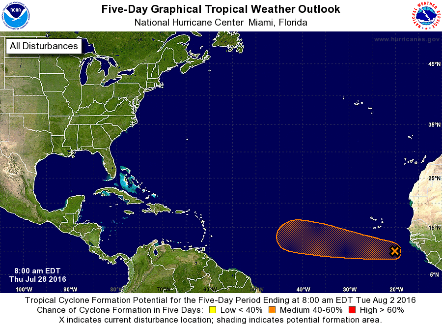
1. A tropical wave accompanied by a low pressure system is producing an
area of showers and thunderstorms about 400 miles southeast of the
Cabo Verde Islands.  Some development of this disturbance is
possible during the next few days while it moves westward or
west-northwestward at 10 to 15 mph. However, environmental
conditions are expected to become less conducive for development
early next week when the system is over the central tropical
Atlantic Ocean.
* Formation chance through 48 hours...low...30 percent
* Formation chance through 5 days...medium...40 percent

Forecaster Stewart


List of Atlantic Outlooks (May 2023 - present)
List of East Pacific Outlooks (May 2023 - present)
List of Central Pacific Outlooks (May 2023 - present)
List of Atlantic Outlooks (July 2014 - April 2023)
List of East Pacific Outlooks (July 2014 - April 2023)
List of Central Pacific Outlooks (June 2019 - April 2023)
List of Atlantic Outlooks (June 2009 - June 2014)
List of East Pacific Outlooks (June 2009 - June 2014)