ZCZC MIATWOAT ALL
TTAA00 KNHC DDHHMM
TROPICAL WEATHER OUTLOOK
NWS NATIONAL HURRICANE CENTER MIAMI FL
200 PM EDT SAT JUN 18 2016
For the North Atlantic...Caribbean Sea and the Gulf of Mexico:
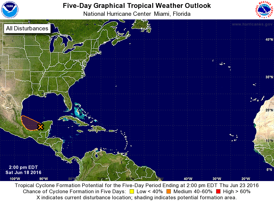
1. A broad area of low pressure has developed offshore of the west
coast of the Yucatan Peninsula today, but the associated shower and
thunderstorm activity remains disorganized. Some gradual development
of this system is expected during the next couple of days in an
environment of marginal upper-level winds, and a tropical depression
could form while the system moves westward to west-northwestward at
around 10 mph before moving inland over eastern Mexico. An Air Force
Reserve Hurricane Hunter aircraft is scheduled to investigate this
system Sunday afternoon, if necessary. For additional information
on this system, see High Seas Forecasts issued by the National
Weather Service.
* Formation chance through 48 hours...medium...50 percent
* Formation chance through 5 days...medium...50 percent
High Seas Forecasts issued by the National Weather Service are
available under AWIPS header NFDHSFAT1, WMO header FZNT01 KWBC, and
on the Web at http://www.opc.ncep.noaa.gov/shtml/NFDHSFAT1.shtml.
Forecaster Brennan