ZCZC MIATWOAT ALL
TTAA00 KNHC DDHHMM
TROPICAL WEATHER OUTLOOK
NWS NATIONAL HURRICANE CENTER MIAMI FL
800 PM EDT FRI JUN 17 2016
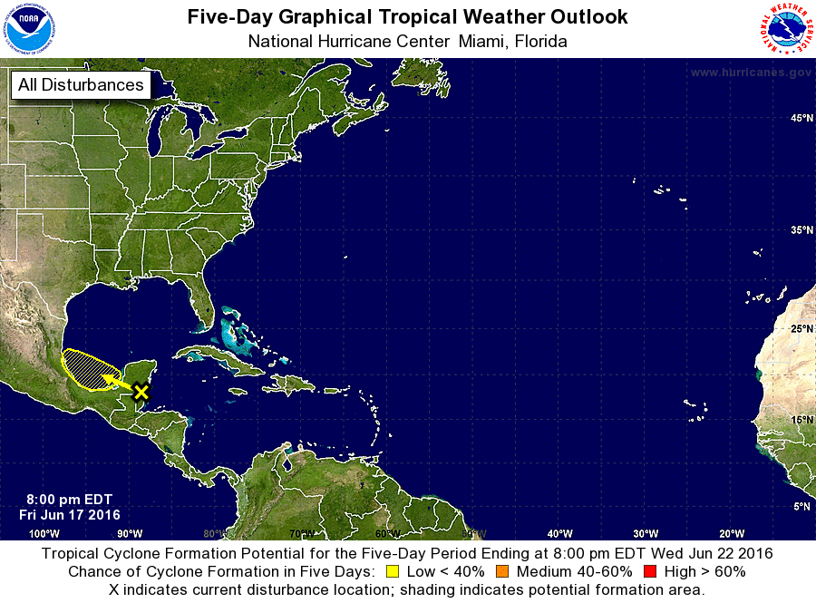
For the North Atlantic...Caribbean Sea and the Gulf of Mexico:
1. A tropical wave is producing disorganized thunderstorms and
cloudiness over the Yucatan peninsula of Mexico, Belize, northern
Guatemala, and adjacent waters of the northwestern Caribbean Sea.
Any development of this disturbance should be slow to occur due to
proximity to land and only marginally conducive upper-level winds.
The system is forecast to move westward to west-northwestward at
about 10 mph during the next few days, and emerge over the Bay of
Campeche and the southwestern Gulf of Mexico by Sunday.
* Formation chance through 48 hours...low...10 percent
* Formation chance through 5 days...low...30 percent
Forecaster Stewart