


NHC Graphical Outlook Archive
|
« Earliest Available ‹ Earlier Later › Latest Available » |
GIS Shapefiles |
| Eastern North Pacific | Atlantic |
|
Tropical Weather Outlook Text
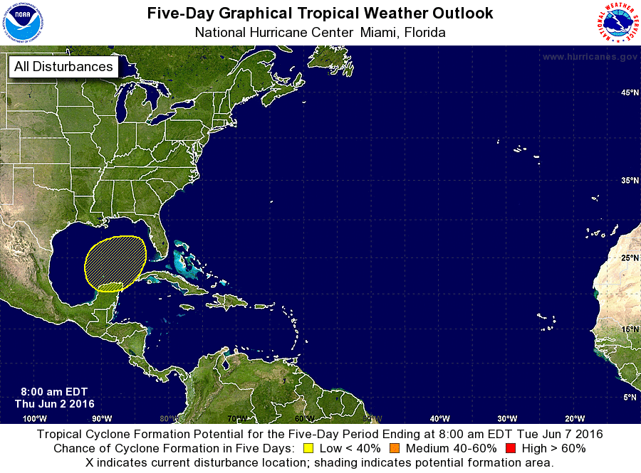
ZCZC MIATWOAT ALL
TTAA00 KNHC DDHHMM

TROPICAL WEATHER OUTLOOK
NWS NATIONAL HURRICANE CENTER MIAMI FL
800 AM EDT THU JUN 2 2016

For the North Atlantic...Caribbean Sea and the Gulf of Mexico:

The NOAA Weather Prediction Center is issuing advisories on
Post-Tropical Cyclone Bonnie, located about 15 miles south of
Cape Hatteras, North Carolina.  Satellite and radar data indicate
that this system is re-gaining tropical cyclone characteristics,
and the National Hurricane Center will resume advisories on
Tropical Depression Bonnie at 11 AM EDT.

1. A broad low pressure area is expected to form over the southern Gulf
of Mexico by early next week.  Additional slow development of the
low could occur as it subsequently moves north-northeastward.
* Formation chance through 48 hours...low...near 0 percent
* Formation chance through 5 days...low...30 percent

Forecaster Beven
List of Atlantic Outlooks (May 2023 - present)
List of East Pacific Outlooks (May 2023 - present)
List of Central Pacific Outlooks (May 2023 - present)
List of Atlantic Outlooks (July 2014 - April 2023)
List of East Pacific Outlooks (July 2014 - April 2023)
List of Central Pacific Outlooks (June 2019 - April 2023)
List of Atlantic Outlooks (June 2009 - June 2014)
List of East Pacific Outlooks (June 2009 - June 2014)