


NHC Graphical Outlook Archive
|
« Earliest Available ‹ Earlier Later › Latest Available » |
GIS Shapefiles |
| Eastern North Pacific | Atlantic |
|
Tropical Weather Outlook Text
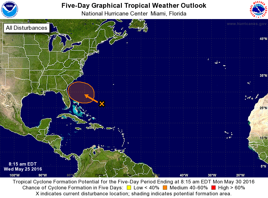
ZCZC MIATWOAT ALL
TTAA00 KNHC DDHHMM

SPECIAL TROPICAL WEATHER OUTLOOK
NWS NATIONAL HURRICANE CENTER MIAMI FL
815 AM EDT WED MAY 25 2016

For the North Atlantic...Caribbean Sea and the Gulf of Mexico:

1. An area of cloudiness and showers over the western Atlantic Ocean
northeast of the Bahamas is associated with the interaction of an
upper-level trough and a weakening front. While development is not
anticipated for the next couple of days, environmental conditions
are expected to become more conducive for tropical or subtropical
development on Friday. This area of disturbed weather is forecast to
move slowly west-northwestward or northwestward and gradually
approach the southeastern United States over the weekend. The next
Special Tropical Weather Outlook will be issued by 8 PM EDT tonight.
* Formation chance through 48 hours...low...10 percent
* Formation chance through 5 days...medium...50 percent

Forecaster Blake
List of Atlantic Outlooks (May 2023 - present)
List of East Pacific Outlooks (May 2023 - present)
List of Central Pacific Outlooks (May 2023 - present)
List of Atlantic Outlooks (July 2014 - April 2023)
List of East Pacific Outlooks (July 2014 - April 2023)
List of Central Pacific Outlooks (June 2019 - April 2023)
List of Atlantic Outlooks (June 2009 - June 2014)
List of East Pacific Outlooks (June 2009 - June 2014)