


NHC Graphical Outlook Archive
|
« Earliest Available ‹ Earlier Later › Latest Available » |
GIS Shapefiles |
| Eastern North Pacific | Atlantic |
|
Tropical Weather Outlook Text
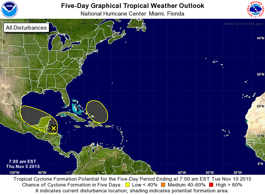
ZCZC MIATWOAT ALL
TTAA00 KNHC DDHHMM

TROPICAL WEATHER OUTLOOK
NWS NATIONAL HURRICANE CENTER MIAMI FL
700 AM EST THU NOV 5 2015

For the North Atlantic...Caribbean Sea and the Gulf of Mexico:

1. Satellite imagery and surface observations indicate that a broad
low pressure area, associated with a tropical wave, has formed over
the northwestern Caribbean Sea.  This system is expected to move
west-northwestward across the Yucatan Peninsula into the
southwestern Gulf of Mexico by the weekend.  Some slow development
is possible during the couple of days.  After that time, the low is
expected to encounter a cold front, which would make additional
development unlikely.
* Formation chance through 48 hours...low...10 percent
* Formation chance through 5 days...low...10 percent

2. An area of low pressure could form near or to the north of Puerto
Rico and Hispaniola late this weekend.  Some slow development of
this system is possible early next week while it moves
northwestward.
* Formation chance through 48 hours...low...near 0 percent
* Formation chance through 5 days...low...20 percent

Forecaster Beven
List of Atlantic Outlooks (May 2023 - present)
List of East Pacific Outlooks (May 2023 - present)
List of Central Pacific Outlooks (May 2023 - present)
List of Atlantic Outlooks (July 2014 - April 2023)
List of East Pacific Outlooks (July 2014 - April 2023)
List of Central Pacific Outlooks (June 2019 - April 2023)
List of Atlantic Outlooks (June 2009 - June 2014)
List of East Pacific Outlooks (June 2009 - June 2014)