


NHC Graphical Outlook Archive
|
« Earliest Available ‹ Earlier Later › Latest Available » |
GIS Shapefiles |
| Eastern North Pacific | Atlantic |
|
Tropical Weather Outlook Text
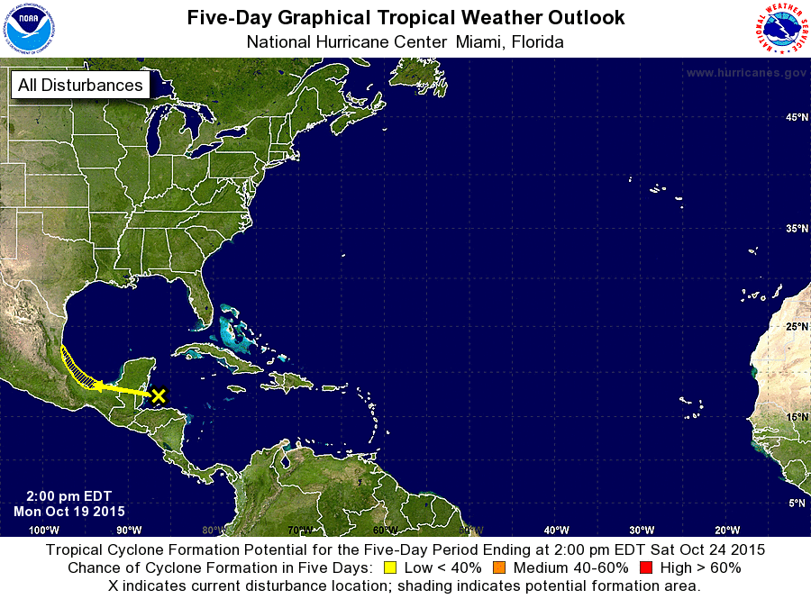
ZCZC MIATWOAT ALL
TTAA00 KNHC DDHHMM

TROPICAL WEATHER OUTLOOK
NWS NATIONAL HURRICANE CENTER MIAMI FL
200 PM EDT MON OCT 19 2015

For the North Atlantic...Caribbean Sea and the Gulf of Mexico:

1. Showers and thunderstorms over the northwestern Caribbean Sea and
portions of the Yucatan Peninsula are associated with a weak area of
low pressure.  Only marginally conducive upper-level winds and the
potential for this system to interact with land should preclude
significant development as this disturbance moves westward to west-
northwestward into the Bay of Campeche and the extreme southwestern
Gulf of Mexico during the next few days.  Regardless of tropical
cyclone formation, locally heavy rains associated with this system
should spread from the Yucatan Peninsula across southeastern Mexico
during the next few days.
* Formation chance through 48 hours...low...near 0 percent
* Formation chance through 5 days...low...10 percent

Forecaster Kimberlain
List of Atlantic Outlooks (May 2023 - present)
List of East Pacific Outlooks (May 2023 - present)
List of Central Pacific Outlooks (May 2023 - present)
List of Atlantic Outlooks (July 2014 - April 2023)
List of East Pacific Outlooks (July 2014 - April 2023)
List of Central Pacific Outlooks (June 2019 - April 2023)
List of Atlantic Outlooks (June 2009 - June 2014)
List of East Pacific Outlooks (June 2009 - June 2014)