


NHC Graphical Outlook Archive
|
« Earliest Available ‹ Earlier Later › Latest Available » |
GIS Shapefiles |
| Eastern North Pacific | Atlantic |
|
Tropical Weather Outlook Text
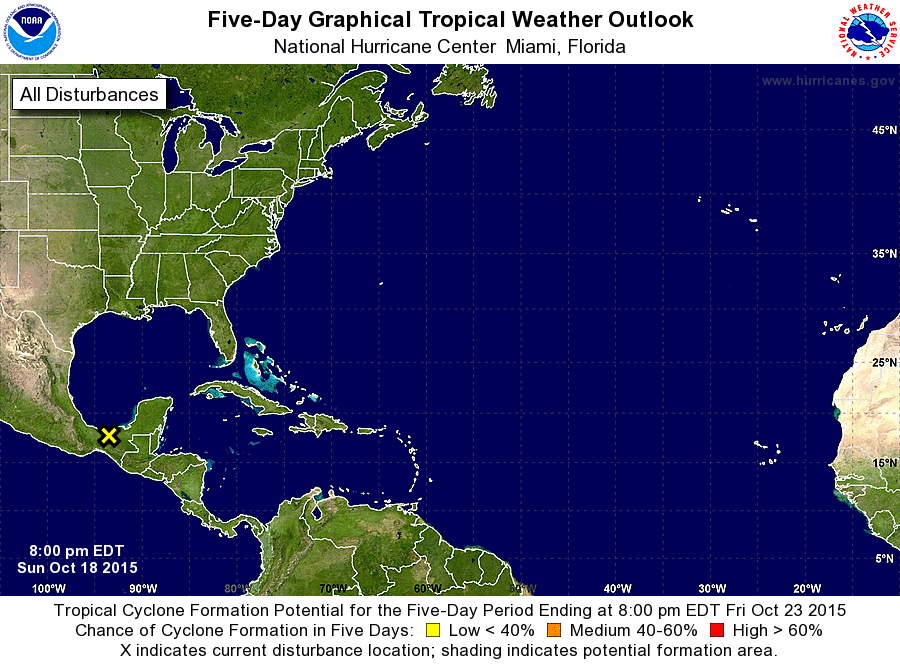
ZCZC MIATWOAT ALL
TTAA00 KNHC DDHHMM

TROPICAL WEATHER OUTLOOK
NWS NATIONAL HURRICANE CENTER MIAMI FL
800 PM EDT SUN OCT 18 2015

For the North Atlantic...Caribbean Sea and the Gulf of Mexico:

1. A broad area of low pressure located inland over the Isthmus of
Tehuantepec is producing disorganized showers and a few
thunderstorms over the Bay of Campeche, southeastern Mexico, and the
Yucatan Peninsula.  This system is likely to remain over land,
and development is therefore not expected.  Locally heavy rainfall
is still possible across portions of southeastern Mexico and the
Yucatan Peninsula during the next day or two.
* Formation chance through 48 hours...low...near 0 percent
* Formation chance through 5 days...low...near 0 percent

Forecaster Berg
List of Atlantic Outlooks (May 2023 - present)
List of East Pacific Outlooks (May 2023 - present)
List of Central Pacific Outlooks (May 2023 - present)
List of Atlantic Outlooks (July 2014 - April 2023)
List of East Pacific Outlooks (July 2014 - April 2023)
List of Central Pacific Outlooks (June 2019 - April 2023)
List of Atlantic Outlooks (June 2009 - June 2014)
List of East Pacific Outlooks (June 2009 - June 2014)