


NHC Graphical Outlook Archive
|
« Earliest Available ‹ Earlier Later › Latest Available » |
GIS Shapefiles |
| Eastern North Pacific | Atlantic |
|
Tropical Weather Outlook Text
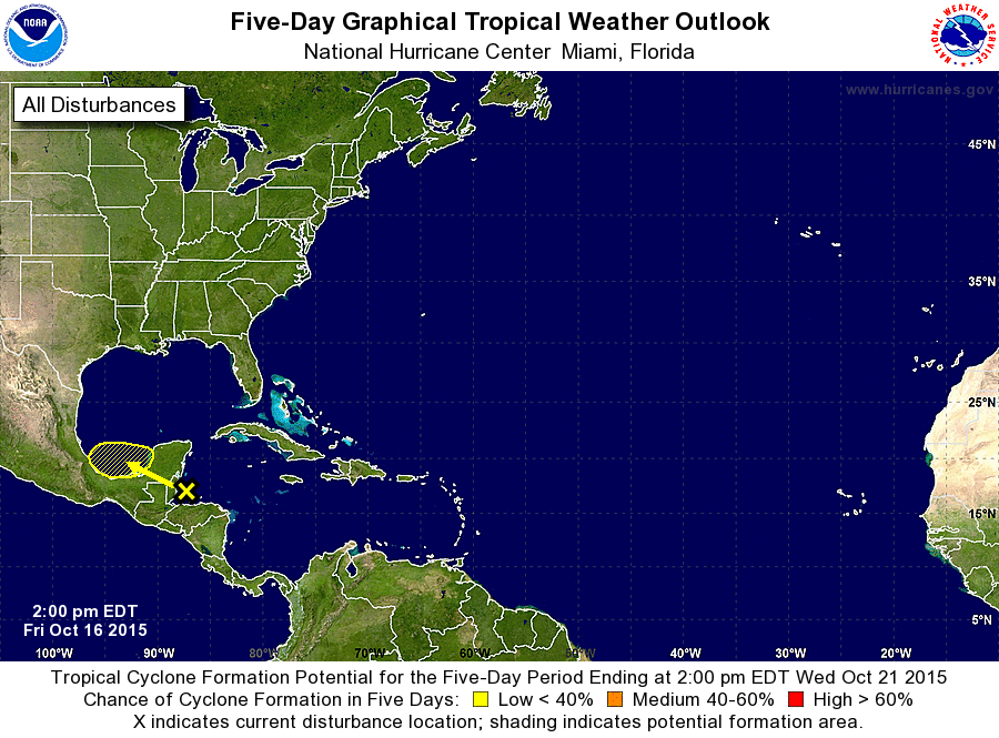
ZCZC MIATWOAT ALL
TTAA00 KNHC DDHHMM

TROPICAL WEATHER OUTLOOK
NWS NATIONAL HURRICANE CENTER MIAMI FL
200 PM EDT FRI OCT 16 2015

For the North Atlantic...Caribbean Sea and the Gulf of Mexico:

1. A broad area of low pressure located in the Gulf of Honduras
associated with a tropical wave is producing a large area of
cloudiness, showers, and thunderstorms across portions of the
northwestern Caribbean Sea. Land interaction is expected to preclude
significant development of this system during the next day or so
while it moves slowly west-northwestward across the Yucatan
Peninsula. However, some limited development is possible on Sunday
or Monday if the system emerges into the Bay of Campeche. Regardless
of tropical cyclone formation, this system could produce heavy
rainfall across portions of Belize and the Yucatan Peninsula through
the weekend.
* Formation chance through 48 hours...low...10 percent
* Formation chance through 5 days...low...20 percent

Forecaster Brennan
List of Atlantic Outlooks (May 2023 - present)
List of East Pacific Outlooks (May 2023 - present)
List of Central Pacific Outlooks (May 2023 - present)
List of Atlantic Outlooks (July 2014 - April 2023)
List of East Pacific Outlooks (July 2014 - April 2023)
List of Central Pacific Outlooks (June 2019 - April 2023)
List of Atlantic Outlooks (June 2009 - June 2014)
List of East Pacific Outlooks (June 2009 - June 2014)