


NHC Graphical Outlook Archive
|
« Earliest Available ‹ Earlier Later › Latest Available » |
GIS Shapefiles |
| Eastern North Pacific | Atlantic |
|
Tropical Weather Outlook Text
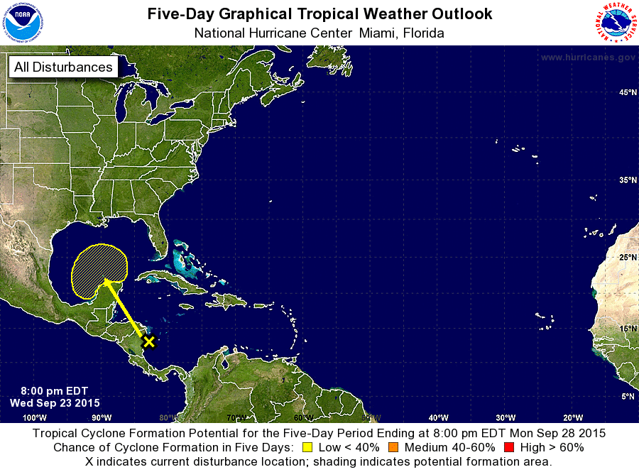
ZCZC MIATWOAT ALL
TTAA00 KNHC DDHHMM

TROPICAL WEATHER OUTLOOK
NWS NATIONAL HURRICANE CENTER MIAMI FL
800 PM EDT WED SEP 23 2015

For the North Atlantic...Caribbean Sea and the Gulf of Mexico:

The National Hurricane Center is issuing advisories on Tropical
Storm Ida, located about 1000 miles east of the northern Leeward
Islands.

1. Disorganized showers and thunderstorms over the southwestern
Caribbean Sea are associated with a trough of low pressure.  While
environmental conditions are not favorable for development over the
next couple of days, this system is expected to be approaching the
southern Gulf of Mexico over the weekend.  Although upper-level
winds are not expected to be particularly conducive there, some
development is possible while the system moves northward early next
week.
* Formation chance through 48 hours...low...near 0 percent
* Formation chance through 5 days...low...20 percent

Forecaster Blake
List of Atlantic Outlooks (May 2023 - present)
List of East Pacific Outlooks (May 2023 - present)
List of Central Pacific Outlooks (May 2023 - present)
List of Atlantic Outlooks (July 2014 - April 2023)
List of East Pacific Outlooks (July 2014 - April 2023)
List of Central Pacific Outlooks (June 2019 - April 2023)
List of Atlantic Outlooks (June 2009 - June 2014)
List of East Pacific Outlooks (June 2009 - June 2014)