


NHC Graphical Outlook Archive
|
« Earliest Available ‹ Earlier Later › Latest Available » |
GIS Shapefiles |
| Eastern North Pacific | Atlantic |
|
Tropical Weather Outlook Text
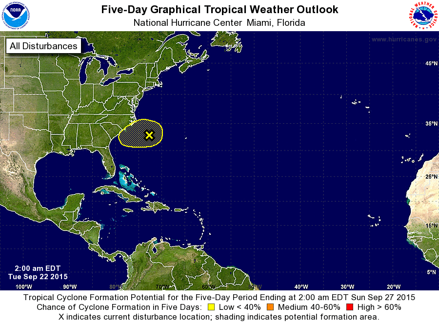
ZCZC MIATWOAT ALL
TTAA00 KNHC DDHHMM

TROPICAL WEATHER OUTLOOK
NWS NATIONAL HURRICANE CENTER MIAMI FL
200 AM EDT TUE SEP 22 2015

For the North Atlantic...Caribbean Sea and the Gulf of Mexico:

The National Hurricane Center is issuing advisories on Tropical
Storm Ida, located more than 900 miles east-northeast of the
northern Leeward Islands.

1. A large non-tropical low pressure system located about 250 miles
southeast of Cape Hatteras, North Carolina, is producing an area of
disorganized showers and thunderstorms mainly north of the center.
Although upper-level winds are expected to be only marginally
conducive for development, this system could possibly acquire
subtropical characteristics over the next couple of days while it
moves slowly westward.
* Formation chance through 48 hours...low...10 percent
* Formation chance through 5 days...low...20 percent

Additional information on this low pressure system can be found in
High Seas Forecasts issued by the National Weather Service, under
AWIPS header NFDHFSAT1, WMO Header FXNT01 KWBC, and available on
the Web at http://www.opc.ncep.noaa.gov/shtml/NFDHSFAT1.shtml.

Forecaster Stewart
List of Atlantic Outlooks (May 2023 - present)
List of East Pacific Outlooks (May 2023 - present)
List of Central Pacific Outlooks (May 2023 - present)
List of Atlantic Outlooks (July 2014 - April 2023)
List of East Pacific Outlooks (July 2014 - April 2023)
List of Central Pacific Outlooks (June 2019 - April 2023)
List of Atlantic Outlooks (June 2009 - June 2014)
List of East Pacific Outlooks (June 2009 - June 2014)