


NHC Graphical Outlook Archive
|
« Earliest Available ‹ Earlier Later › Latest Available » |
GIS Shapefiles |
| Eastern North Pacific | Atlantic |
|
Tropical Weather Outlook Text
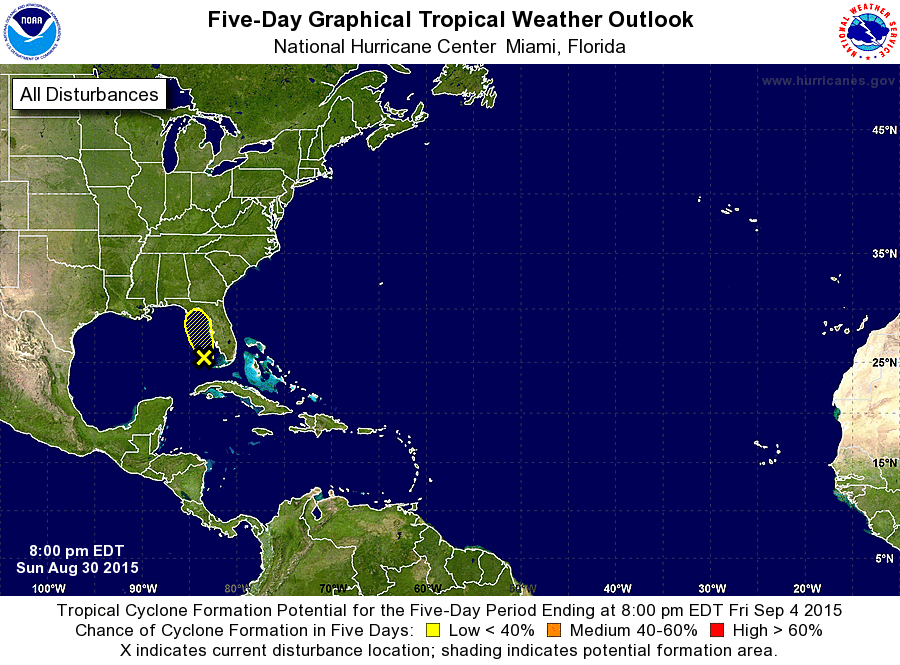
ZCZC MIATWOAT ALL
TTAA00 KNHC DDHHMM

TROPICAL WEATHER OUTLOOK
NWS NATIONAL HURRICANE CENTER MIAMI FL
800 PM EDT SUN AUG 30 2015

For the North Atlantic...Caribbean Sea and the Gulf of Mexico:

The National Hurricane Center is issuing advisories on Tropical
Storm Fred, located which is nearing the Cape Verde Islands.

1. The remnants of Erika, a trough of low pressure over the eastern
Gulf of Mexico, continue to produce areas of heavy rains over
portions of the Florida peninsula, the Florida Keys, and the
western half of Cuba. Upper-level winds are expected to remain
unfavorable for development, and tropical cyclone formation is not
expected.  Additional information on this system can be found in
local forecast products issued by the National Weather Service and
the meteorological service of Cuba.
* Formation chance through 48 hours...low...near 0 percent
* Formation chance through 5 days...low...near 0 percent

Public Advisories on Tropical Storm Fred are issued under WMO
header WTNT31 KNHC and under AWIPS header MIATCPAT1.
Forecast/Advisories on Tropical Storm Fred are issued under WMO
header WTNT21 KNHC and under AWIPS header MIATCMAT1.

Forecaster Kimberlain
List of Atlantic Outlooks (May 2023 - present)
List of East Pacific Outlooks (May 2023 - present)
List of Central Pacific Outlooks (May 2023 - present)
List of Atlantic Outlooks (July 2014 - April 2023)
List of East Pacific Outlooks (July 2014 - April 2023)
List of Central Pacific Outlooks (June 2019 - April 2023)
List of Atlantic Outlooks (June 2009 - June 2014)
List of East Pacific Outlooks (June 2009 - June 2014)