


NHC Graphical Outlook Archive
|
« Earliest Available ‹ Earlier Later › Latest Available » |
GIS Shapefiles |
| Eastern North Pacific | Atlantic |
|
Tropical Weather Outlook Text
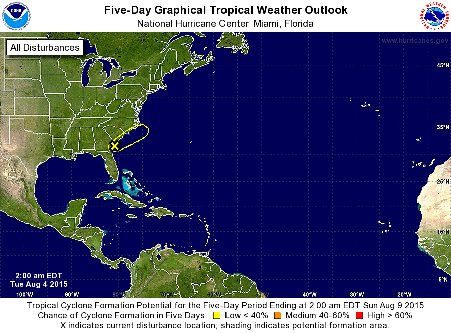
ZCZC MIATWOAT ALL
TTAA00 KNHC DDHHMM

TROPICAL WEATHER OUTLOOK
NWS NATIONAL HURRICANE CENTER MIAMI FL
200 AM EDT TUE AUG 4 2015

For the North Atlantic...Caribbean Sea and the Gulf of Mexico:

1. A weak area of low pressure located along the Georgia coast is
producing disorganized shower and thunderstorm activity. Upper-
level winds are not expected to be conducive for development while
this low moves northeastward at about 10 mph near the southeastern
United States coast during the next day or so. For additional
information on this system, see High Seas Forecasts issued by the
National Weather Service.
* Formation chance through 48 hours...low...10 percent
* Formation chance through 5 days...low...10 percent

High Seas Forecasts issued by the National Weather Service can be
found under AWIPS header NFDHSFAT1 and WMO header FZNT01 KWBC.

Forecaster Brennan
List of Atlantic Outlooks (May 2023 - present)
List of East Pacific Outlooks (May 2023 - present)
List of Central Pacific Outlooks (May 2023 - present)
List of Atlantic Outlooks (July 2014 - April 2023)
List of East Pacific Outlooks (July 2014 - April 2023)
List of Central Pacific Outlooks (June 2019 - April 2023)
List of Atlantic Outlooks (June 2009 - June 2014)
List of East Pacific Outlooks (June 2009 - June 2014)