


NHC Graphical Outlook Archive
|
« Earliest Available ‹ Earlier Later › Latest Available » |
| Eastern Pacific | Atlantic |
|
|
(mouse over shaded areas for details; click on shaded areas or disturbance numbers to switch views) |
Tropical Weather Outlook Text
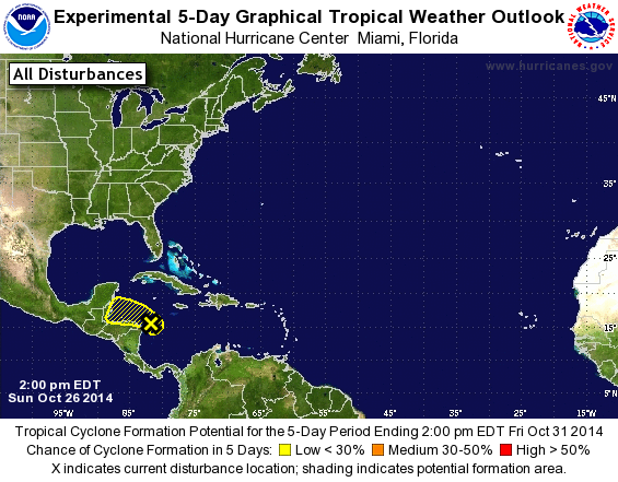
TROPICAL WEATHER OUTLOOK
NWS NATIONAL HURRICANE CENTER MIAMI FL
200 PM EDT SUN OCT 26 2014

For the North Atlantic...Caribbean Sea and the Gulf of Mexico:

1. A small low pressure system, the remnants of Tropical Depression
Nine, is located over the northwestern Caribbean Sea just east of
the Honduras-Nicaragua border. Although shower and thunderstorm
activity has increased some during the past several hours, any
redevelopment of this disturbance should be slow to occur while it
moves slowly westward to west-northwestward over the next few days
due to proximity to land and unfavorable upper-level winds.
* Formation chance through 48 hours...low...10 percent.
* Formation chance through 5 days...low...20 percent.

Forecaster Stewart
List of Atlantic Outlooks (May 2023 - present)
List of East Pacific Outlooks (May 2023 - present)
List of Central Pacific Outlooks (May 2023 - present)
List of Atlantic Outlooks (July 2014 - April 2023)
List of East Pacific Outlooks (July 2014 - April 2023)
List of Central Pacific Outlooks (June 2019 - April 2023)
List of Atlantic Outlooks (June 2009 - June 2014)
List of East Pacific Outlooks (June 2009 - June 2014)