


NHC Graphical Outlook Archive
|
« Earliest Available ‹ Earlier Later › Latest Available » |
| Eastern Pacific | Atlantic |
|
|
(mouse over shaded areas for details; click on shaded areas or disturbance numbers to switch views) |
Tropical Weather Outlook Text
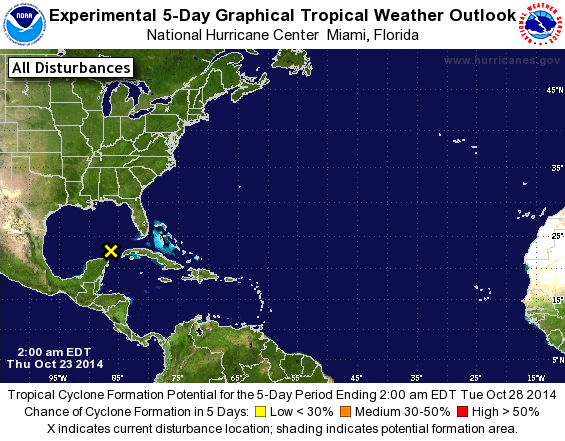
TROPICAL WEATHER OUTLOOK
NWS NATIONAL HURRICANE CENTER MIAMI FL
200 AM EDT THU OCT 23 2014

For the North Atlantic...Caribbean Sea and the Gulf of Mexico:

The National Hurricane Center has issued the last advisory on
Tropical Depression Nine which has degenerated into a remnant low
over the Yucatan peninsula.

1. Satellite imagery and surface observations indicate that a
non-tropical low pressure area is developing over the southeastern
Gulf of Mexico.  The low is expected to move east-northeastward,
and development into a subtropical or tropical cyclone is not
expected to due to unfavorable upper-level winds.  Regardless of
development, this system is likely to produce heavy rainfall and
locally gusty winds over western Cuba, the southern portion of the
Florida Peninsula, and the Florida Keys during the next couple of
days.
* Formation chance through 48 hours...low...near 0 percent.
* Formation chance through 5 days...low...near 0 percent.

Forecaster Brown
List of Atlantic Outlooks (May 2023 - present)
List of East Pacific Outlooks (May 2023 - present)
List of Central Pacific Outlooks (May 2023 - present)
List of Atlantic Outlooks (July 2014 - April 2023)
List of East Pacific Outlooks (July 2014 - April 2023)
List of Central Pacific Outlooks (June 2019 - April 2023)
List of Atlantic Outlooks (June 2009 - June 2014)
List of East Pacific Outlooks (June 2009 - June 2014)