


NHC Graphical Outlook Archive
|
« Earliest Available ‹ Earlier Later › Latest Available » |
| Eastern Pacific | Atlantic |
|
|
(mouse over shaded areas for details; click on shaded areas or disturbance numbers to switch views) |
Tropical Weather Outlook Text
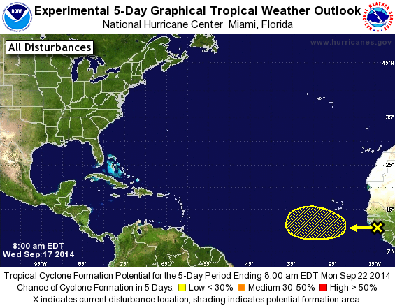
TROPICAL WEATHER OUTLOOK
NWS NATIONAL HURRICANE CENTER MIAMI FL
800 AM EDT WED SEP 17 2014

For the North Atlantic...Caribbean Sea and the Gulf of Mexico:

The National Hurricane Center is issuing advisories on Hurricane
Edouard, located several hundred miles east-northeast of Bermuda.

1. Showers and thunderstorms near the west coast of Africa are
associated with a tropical wave that is forecast to move offshore
later today.  Development of this system is not anticipated through
Thursday, and any development through the weekend is expected to be
slow to occur while the system moves westward at 10 to 15 mph over
the eastern Atlantic.
* Formation chance through 48 hours...low...near 0 percent.
* Formation chance through 5 days...low...10 percent.

Forecaster Blake
List of Atlantic Outlooks (May 2023 - present)
List of East Pacific Outlooks (May 2023 - present)
List of Central Pacific Outlooks (May 2023 - present)
List of Atlantic Outlooks (July 2014 - April 2023)
List of East Pacific Outlooks (July 2014 - April 2023)
List of Central Pacific Outlooks (June 2019 - April 2023)
List of Atlantic Outlooks (June 2009 - June 2014)
List of East Pacific Outlooks (June 2009 - June 2014)