


NHC Graphical Outlook Archive
|
« Earliest Available ‹ Earlier Later › Latest Available » |
| Eastern Pacific | Atlantic |
|
|
(mouse over shaded areas for details; click on shaded areas or disturbance numbers to switch views) |
Tropical Weather Outlook Text
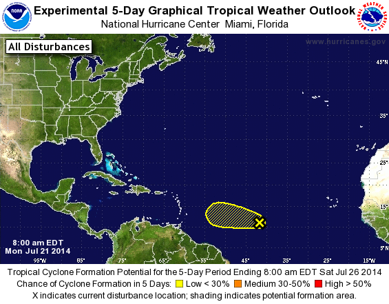
TROPICAL WEATHER OUTLOOK
NWS NATIONAL HURRICANE CENTER MIAMI FL
800 AM EDT MON JUL 21 2014

For the North Atlantic...Caribbean Sea and the Gulf of Mexico:

1. Shower activity associated with a broad area of low pressure located
about 1200 miles west-southwest of the Cape Verde Islands has become
a little better organized over the past several hours. However, any
additional development of this system is expected to be slow to
occur over the next couple of days while it moves toward the west or
west-northwest at 15 to 20 mph. After that time, environmental
conditions are expected to become less conducive for development.
* Formation chance through 48 hours...low...20 percent.
* Formation chance through 5 days...low...20 percent.

Forecaster Brennan/Roberts
List of Atlantic Outlooks (May 2023 - present)
List of East Pacific Outlooks (May 2023 - present)
List of Central Pacific Outlooks (May 2023 - present)
List of Atlantic Outlooks (July 2014 - April 2023)
List of East Pacific Outlooks (July 2014 - April 2023)
List of Central Pacific Outlooks (June 2019 - April 2023)
List of Atlantic Outlooks (June 2009 - June 2014)
List of East Pacific Outlooks (June 2009 - June 2014)