


NHC Graphical Outlook Archive
« Earliest Available ‹ Earlier Later › Latest Available »
Place your mouse cursor over areas of interest for more information
| GIS data: .shp |
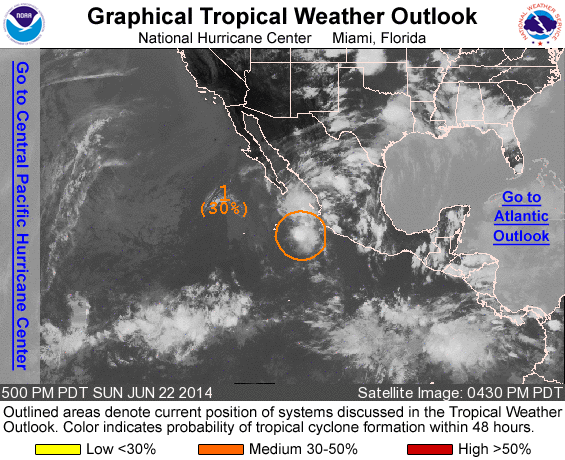
ZCZC MIATWOEP ALL
TTAA00 KNHC DDHHMM

TROPICAL WEATHER OUTLOOK
NWS NATIONAL HURRICANE CENTER MIAMI FL
500 PM PDT SUN JUN 22 2014

For the eastern North Pacific...east of 140 degrees west longitude:

1. Satellite wind data indicate that a low pressure system located
about 350 miles south-southeast of the southern tip of Baja
California, Mexico is gradually becoming better defined.  Although
thunderstorm activity has been increasing near the center during the
past few hours, environmental conditions are only marginally
conducive for additional development to occur during the next day or
so while the disturbance moves northward.
* Formation chance through 48 hours...medium...30 percent.
* Formation chance through 5 days...medium...30 percent.

Forecaster Cangialosi/Stewart
List of all Atlantic Outlooks
List of all East Pacific Outlooks