


NHC Graphical Outlook Archive
« Earliest Available ‹ Earlier Later › Latest Available »
Place your mouse cursor over areas of interest for more information
| GIS data: .shp |
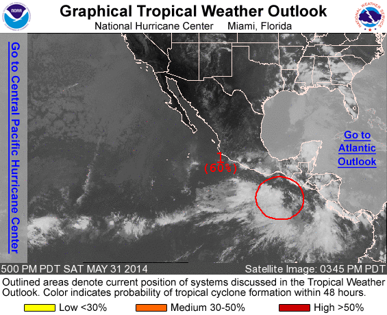
ZCZC MIATWOEP ALL
TTAA00 KNHC DDHHMM

TROPICAL WEATHER OUTLOOK
NWS NATIONAL HURRICANE CENTER MIAMI FL
500 PM PDT SAT MAY 31 2014

For the eastern North Pacific...east of 140 degrees west longitude:

1. A low pressure area located about 300 miles south-southeast of
Puerto Angel, Mexico, has become better defined during the day.
Environmental conditions are becoming increasingly conducive for
development...and a tropical depression will likely form during the
next few days while the low drifts northward. Regardless of tropical
cyclone formation, this system will produce locally heavy rains over
portions of western Central America and southeastern Mexico this
coming week, causing life-threatening flash floods and mudslides.
* Formation chance through 48 hours...high...60 percent
* Formation chance through 5 days...high...80 percent

Forecaster Blake
List of all Atlantic Outlooks
List of all East Pacific Outlooks