


NHC Graphical Outlook Archive
« Earliest Available ‹ Earlier Later › Latest Available »
Place your mouse cursor over areas of interest for more information
| GIS data: .shp |
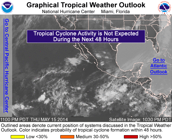
ZCZC MIATWOEP ALL
TTAA00 KNHC DDHHMM

TROPICAL WEATHER OUTLOOK
NWS NATIONAL HURRICANE CENTER MIAMI FL
1100 PM PDT THU MAY 15 2014

For the eastern North Pacific...east of 140 degrees west longitude:

Tropical cyclone formation is not expected over the next 48 hours.

Other systems with the potential to become a tropical cyclone beyond
48 hours...

An area of low pressure is expected to form several hundred miles
south of Mexico over the next day or so. Environmental conditions
should be conducive for gradual development to occur as the system
moves westward to west-northwestward.
* Formation chance through 48 hours...low...near 0 percent
* Formation chance through 5 days...low...20 percent

$$
Forecaster Stewart
NNNN
List of all Atlantic Outlooks
List of all East Pacific Outlooks