


NHC Graphical Outlook Archive
« Earliest Available ‹ Earlier Later › Latest Available »
Place your mouse cursor over areas of interest for more information
| GIS data: .shp |
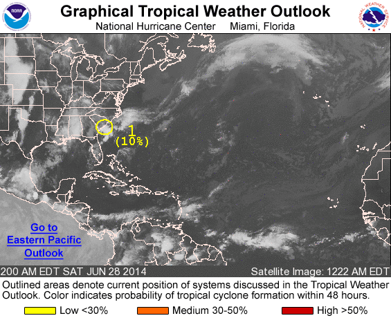
ZCZC MIATWOAT ALL
TTAA00 KNHC DDHHMM

TROPICAL WEATHER OUTLOOK
NWS NATIONAL HURRICANE CENTER MIAMI FL
200 AM EDT SAT JUN 28 2014

For the North Atlantic...Caribbean Sea and the Gulf of Mexico:

1. A weak non-tropical area of low pressure is moving southeastward
off the coast of South Carolina.  Some gradual development of this
system is possible while it lingers off the southeastern coast of
the United States through the middle of next week.
* Formation chance through 48 hours...low...10 percent.
* Formation chance through 5 days...medium...30 percent.

Forecaster Berg
List of all Atlantic Outlooks
List of all East Pacific Outlooks