


NHC Graphical Outlook Archive
« Earliest Available ‹ Earlier Later › Latest Available »
Place your mouse cursor over areas of interest for more information
| GIS data: .shp |
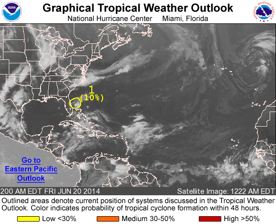
ZCZC MIATWOAT ALL
TTAA00 KNHC DDHHMM

TROPICAL WEATHER OUTLOOK
NWS NATIONAL HURRICANE CENTER MIAMI FL
200 AM EDT FRI JUN 20 2014

For the North Atlantic...Caribbean Sea and the Gulf of Mexico:

1. A weak low pressure area located about 75 miles east of the
east-central coast of Florida is producing disorganized showers and
thunderstorms.  This system has changed little over the past
several hours, and significant development is not expected while it
drifts slowly northward during the next day or so.  After that time,
conditions should remain unfavorable for development while the
disturbance accelerates northeastward.
* Formation chance through 48 hours...low...near 10 percent.
* Formation chance through 5 days...low...near 10 percent.

Forecaster Pasch
List of all Atlantic Outlooks
List of all East Pacific Outlooks