


https://www.hurricanes.gov/marine/forecast
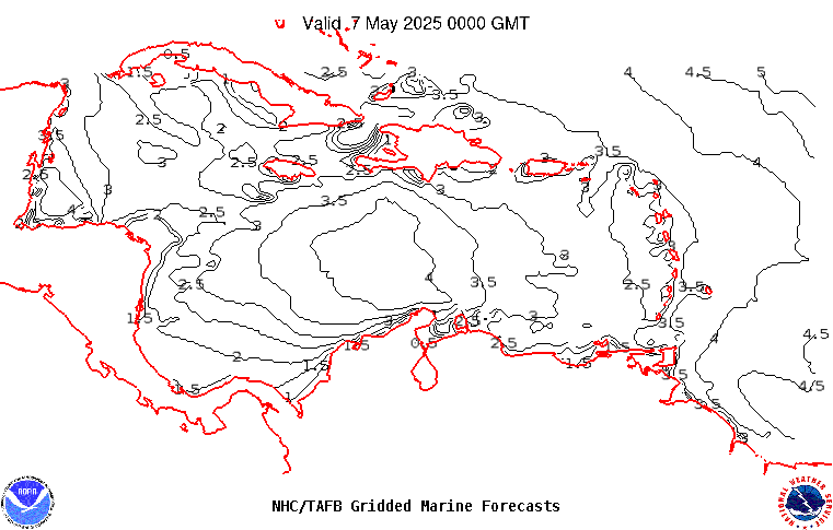
AMZ001-200715- Synopsis for Caribbean Sea, and Tropical N Atlantic from 07N to 19N W of 55W 314 PM EDT Fri Apr 19 2024 .SYNOPSIS...Broad high pressure located between Bermuda and the Bahamas will support fresh to locally strong trade winds in the lee of Cuba, Windward Passage, and south of the Dominican Republic at night during the next few days. These winds will gradually diminish this weekend into early next week as a cold front moves across the western Atlantic and the pressure gradient relaxes. A locally tight pressure gradient will support pulsing fresh to locally strong winds near northern Colombia at night through the period. A surface trough approaching the Windward Islands is accompanied by scattered showers and thunderstorms with gusty winds. The trough will move across the islands into the southeastern Caribbean tonight through the weekend. |