AMZ101-260315-
Synopsis for the SW N Atlantic including the Bahamas
1108 AM EDT Thu Apr 25 2024
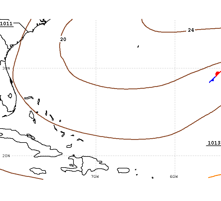
.SYNOPSIS...A stationary front extends from 31N60W to 24N66W and
to near eastern Cuba. The front will weaken to a trough by this
evening. A cold front is forecast to merge with the trough and
progress eastward, reaching from near 31N57W to eastern Cuba
early Sat morning, from near 25N55W to Hispaniola early Sun,
then stall and weaken into a trough over the far southeastern
part late Sun through Mon night. North swell behind the front
will build seas over most of the area northeast of the Bahamas
by Sun. Strengthening high pressure in the wake of the front
will result in fresh to strong north to northeast winds behind
the front from late Fri through Sun. By late Sun, these winds
are expected to be at mainly fresh speeds south of 29N and west
of 60W. At that time, fresh to strong west to northwest winds
are expected over the far northeast forecast waters along with
building seas.