


NHC Graphical Outlook Archive
« Earliest Available ‹ Earlier Later › Latest Available »
Place your mouse cursor over areas of interest for more information
| GIS data: .shp |
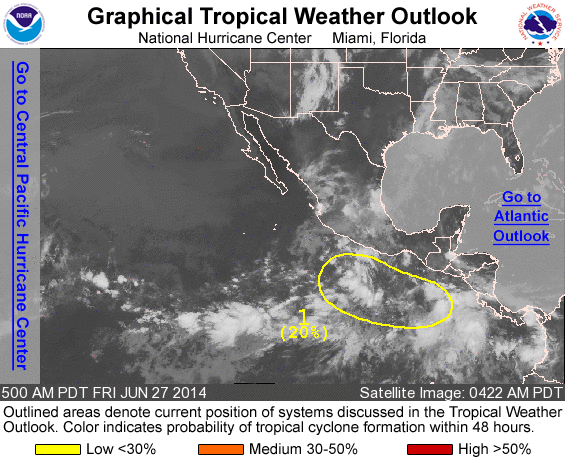
ZCZC MIATWOEP ALL
TTAA00 KNHC DDHHMM

TROPICAL WEATHER OUTLOOK
NWS NATIONAL HURRICANE CENTER MIAMI FL
500 AM PDT FRI JUN 27 2014

For the eastern North Pacific...east of 140 degrees west longitude:

1. Cloudiness and disorganized showers and thunderstorms extend for
several hundred miles offshore of the coast of southern Mexico and
Central America.  An area of low pressure is expected to form within
this region of disturbed weather over the weekend, and conditions
appear favorable for this system to become a tropical cyclone early
next week while it moves west-northwestward.
* Formation chance through 48 hours...low...20 percent.
* Formation chance through 5 days...high...70 percent.

Forecaster Brown
List of all Atlantic Outlooks
List of all East Pacific Outlooks